The Pinch
Advised by: Professor Rosetta Elkin
Collaborators: Hyemin Gu, Tong Shen, Jinying Zhang
This project probes the need for site specificity in actions of retreat. Through an analysis on three case sites situated south of New Bedford, Massachusetts at the mouth of Buzzards Bay, we tested the potential of community managed easements that address ownership, labor, and the reconfiguration of memory.

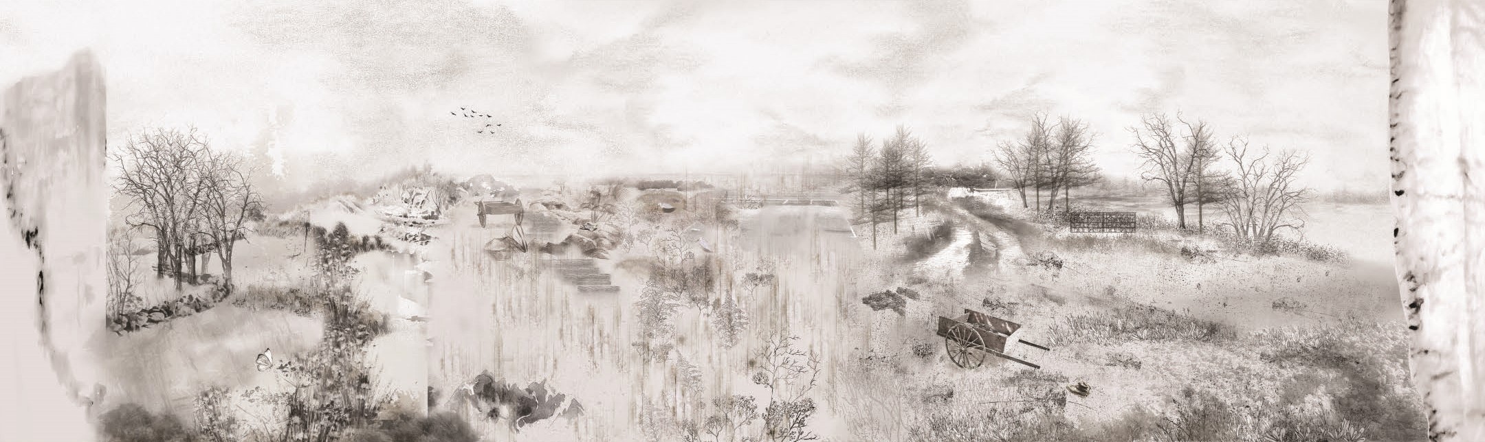
If you trace the coast of Massachusetts, you will find various landscape conditions from migrating salt marsh ecology, coastal cropland, fortified edges, and privatized shorelines. As the shore inevitably moves inland, what strategies do we, as landscape architects, have at our disposal to ensure that the pinch between the rising seas and static land use policies do not squeeze out public access along the shoreline? This project proposes small-scale interventions that mobilize labor over the next 100-years.
What if we were to imagine a future where the community managed their own retreat – where a design linked to memory, loss, and risk opened-up a public corridor that stretched along the entire coast. Where partnerships between local organizations, community members, and landscape architects design a community managed rolling easement that is flexible to change and respectful of time. This corridor not only demarcates a specific elevation but opens up public access along the coast that grows as the shores rise.
This is our envisioned future.
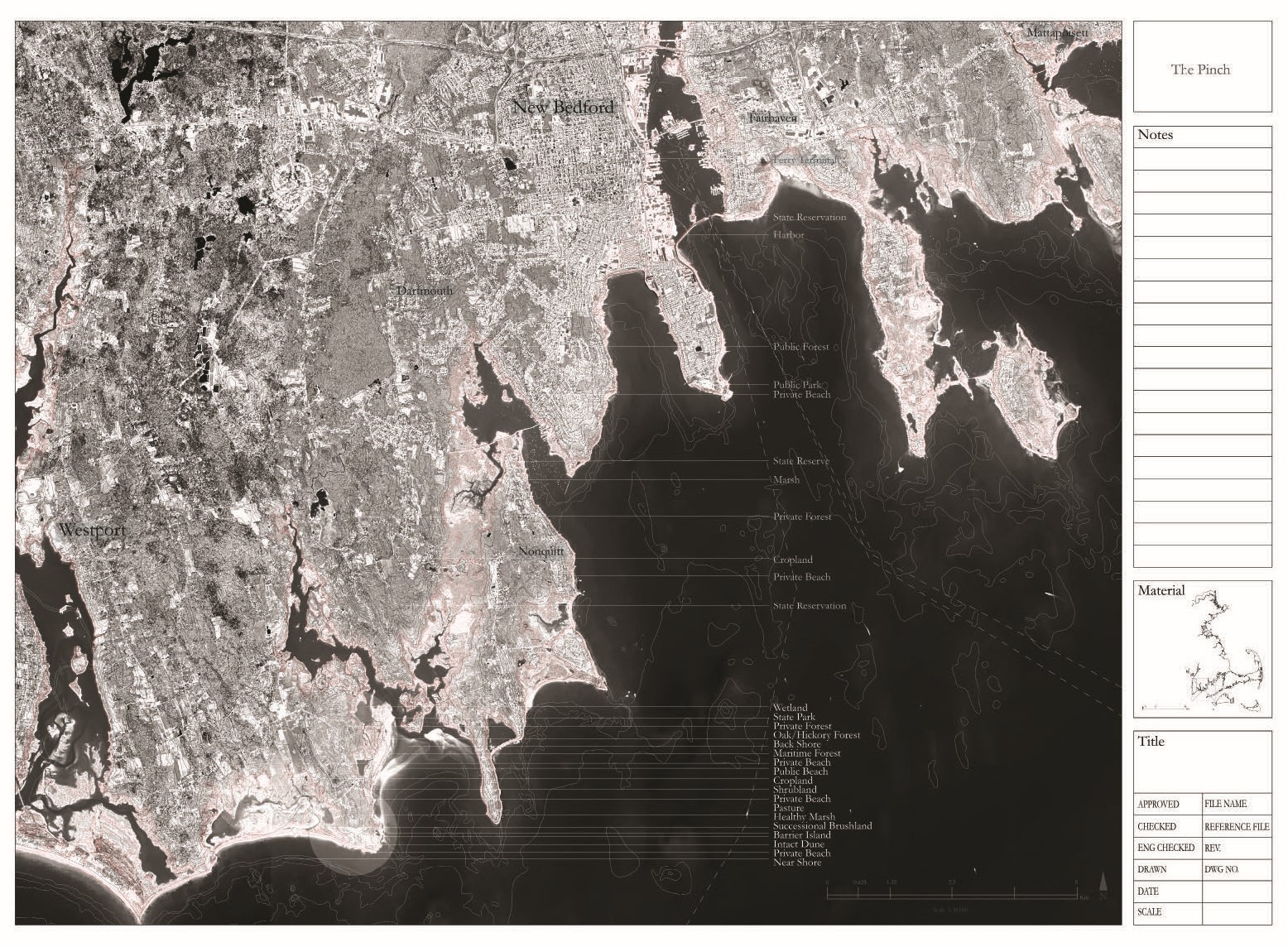
All these complex adjacencies are all under threat as the seas reclaims them. This area near New Beford has been selected due to the accumulation of these adjacencies. This offered a testing ground to develop small-discrete actions that have the potential to expand outward and be applied at a territorial scale.
CASE STUDY SITES
Although these three case studies lie within a few
kilometers from one another, they are vastly different
in their topography, species composition, and land use. This requires a
site-specific proposal for how this easement can roll out. Furthermore, the
relationship between private and public land to impending sea level rise (SLR) varies between the three
sites. “Rolling Memory” addresses both private and public land, “Shared Benefits” is on privately owned land. And lastly, “Rolling Access” addresses a managed retreat on publically owned land (state park). 
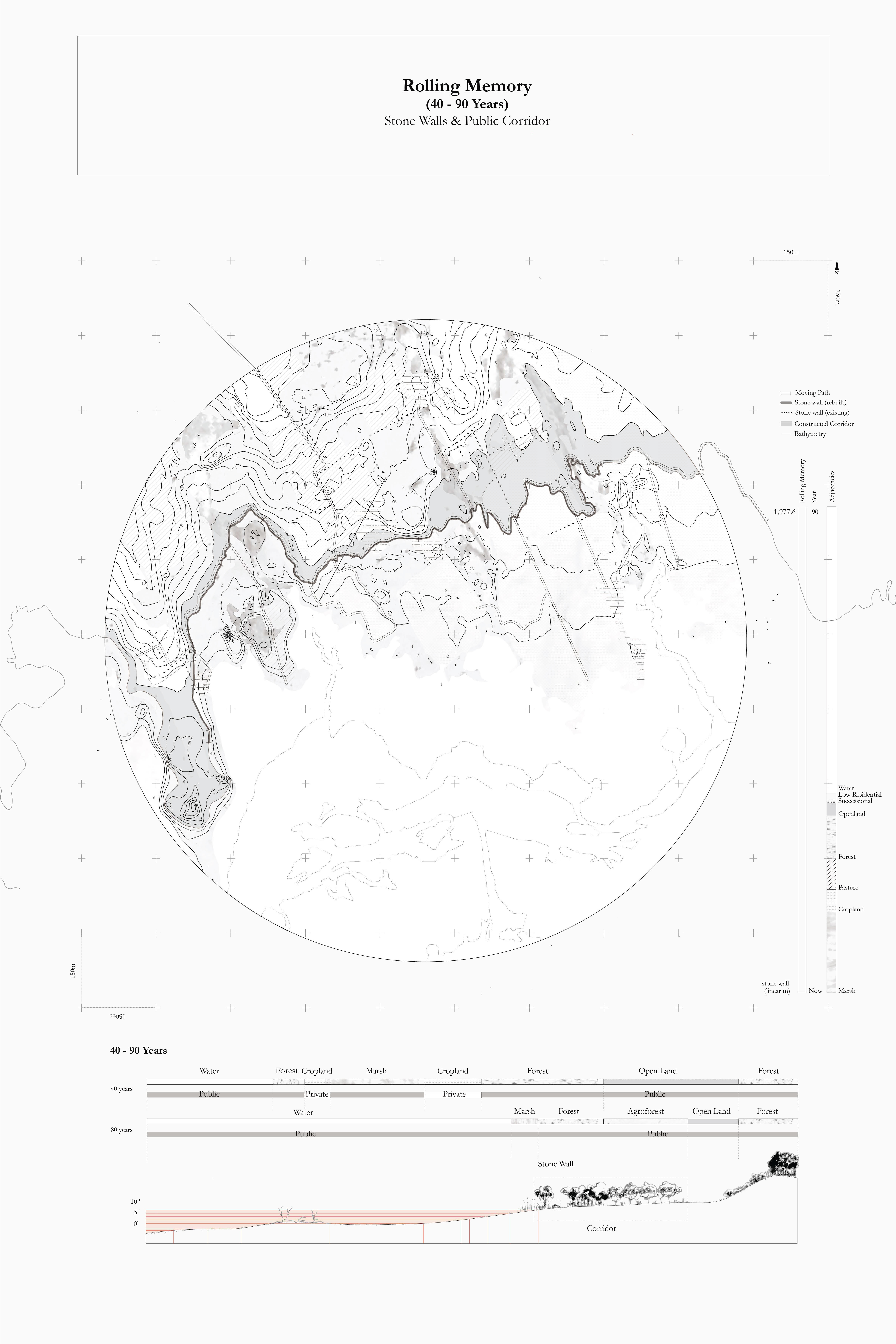
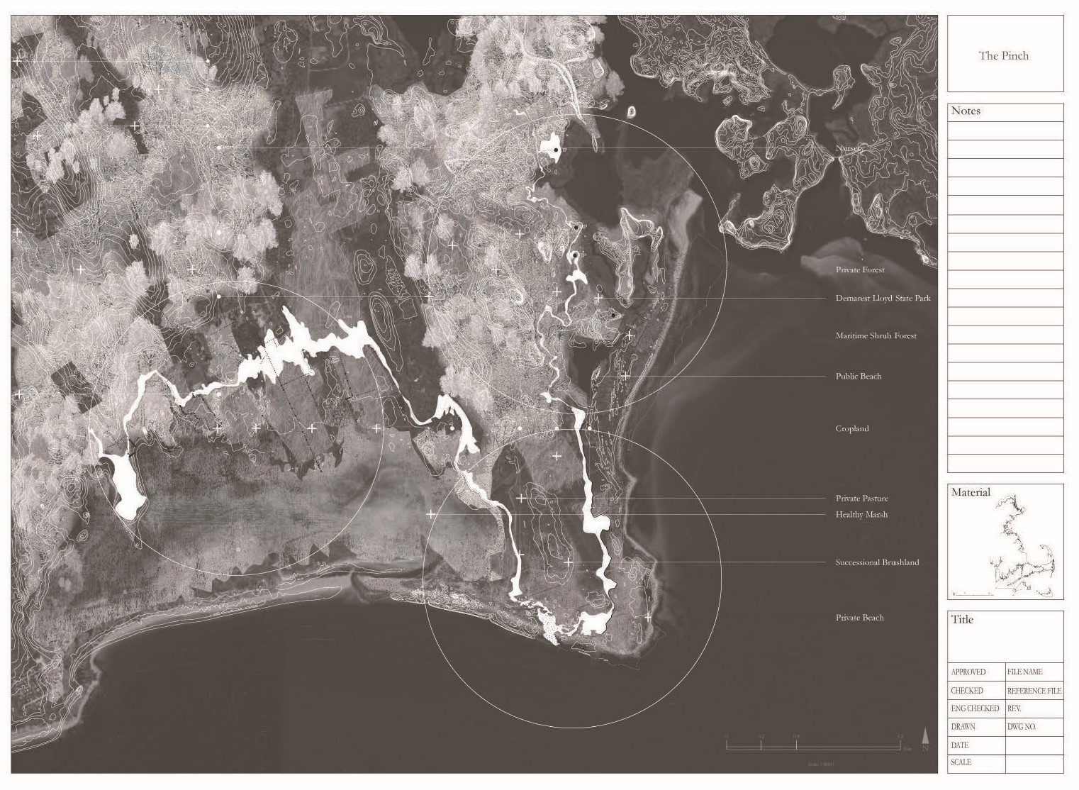
ROLLING MEMORY
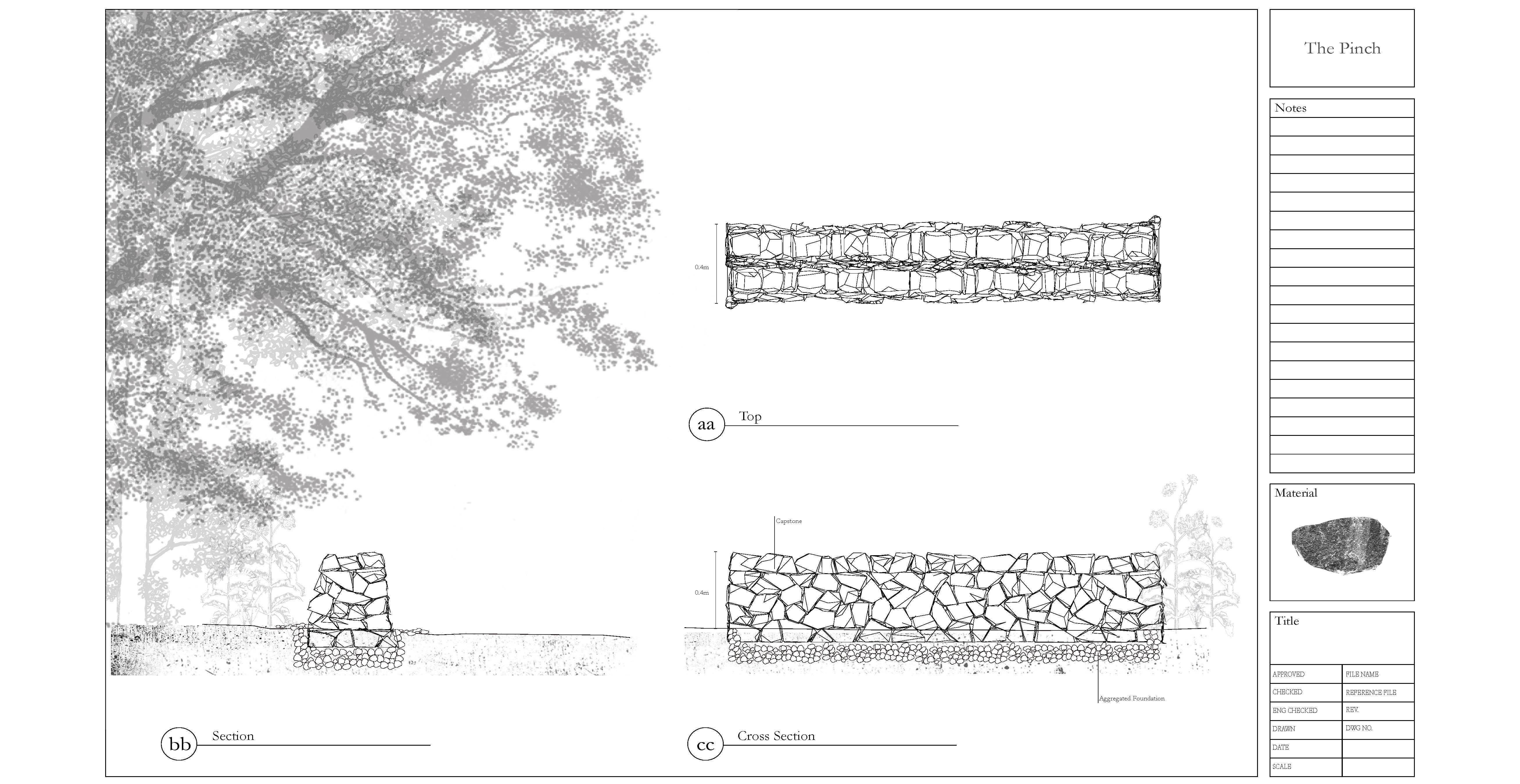
This first proposal addresses memory and loss with the use of sentinel
species that catalyze future interventions. Stonewalls dot the New England
landscape, marking a time when agriculture consumed forests and altered
topography. Many of these existing stone walls constructed on
site during the 18th and 19th century will be lost to the
sea along with the historic farmland that it signifies.
At this site, there is a healthy marsh moving inland with SLR.
Between is the historic farmland and privately owned forest. The
pinch is between the dynamic marsh land and the static boundary of the forest. To address this particular pinch, our proposal is twofold. The easement establishes hedgerows that are planted along each projected SLR contour, intersecting with existing stone walls. This intersection will be planted with two key sentinel species - the Robinia pseudoacacia and Sassafras albidum – which act as markers of time. As the sea moves inland, each segment of the stonewalls will be deconstructed, moved, and rebuilt in the public corridor, marking loss, time, and the reconfiguration of memory within this new common space.


SHARED BENEFITS
As access is expanded along the coastline, you inevitably collide with private land. There is currently no public access at this site. Because ownership has defined set boundary conditions, the dunes and successional brushland at the edge of the property remains intact. With SLR, much of the land and dunes will disappear. We acknowledge this process and utilize the change in the shoreline to connect the public to this corridor, marking this change with woven corduroy roads. These paths are woven together by the hands of the community. Black locust wood is used to indicate each projected SLR contour. As you move down the pathways towards the coast, you pass over future inundation.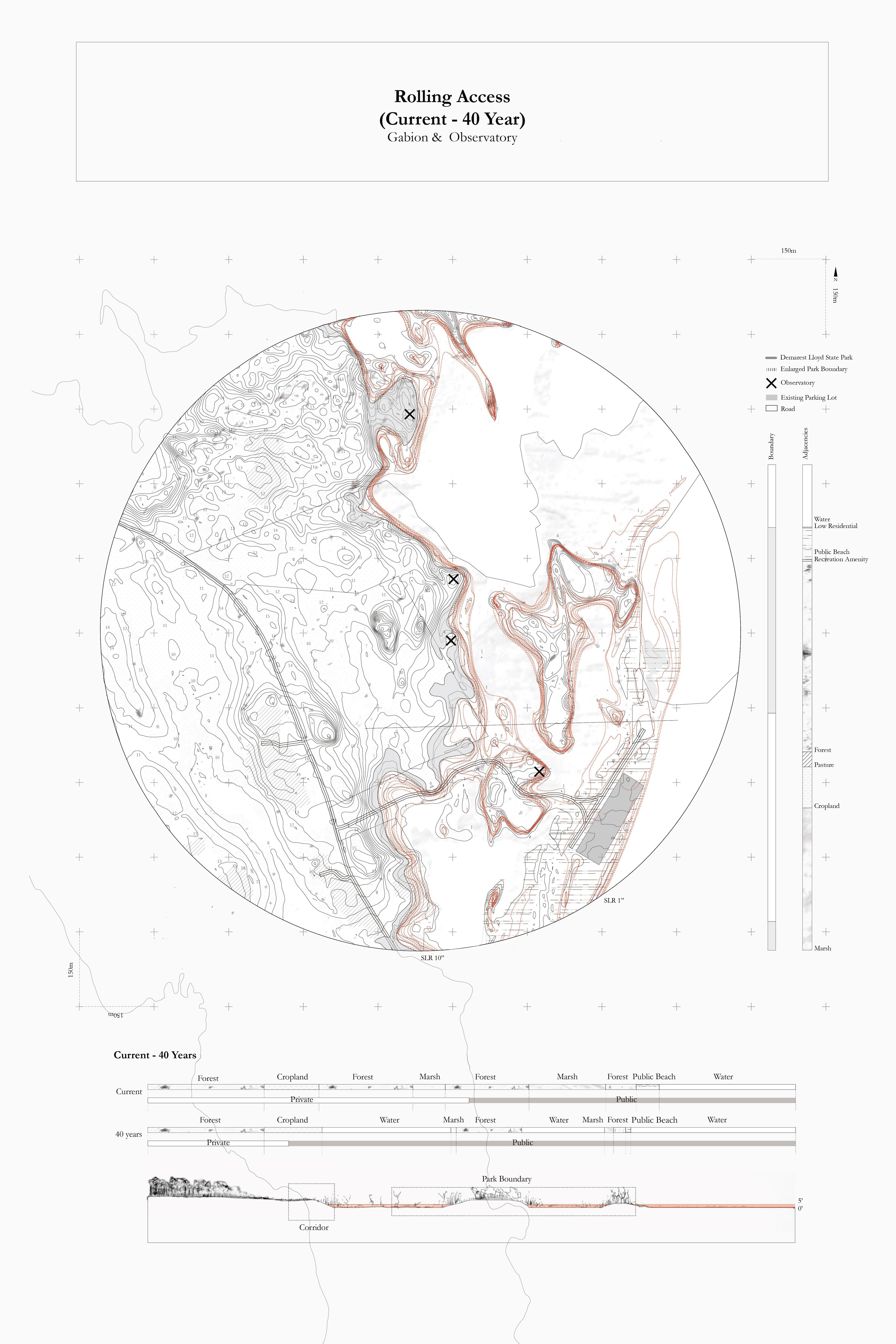
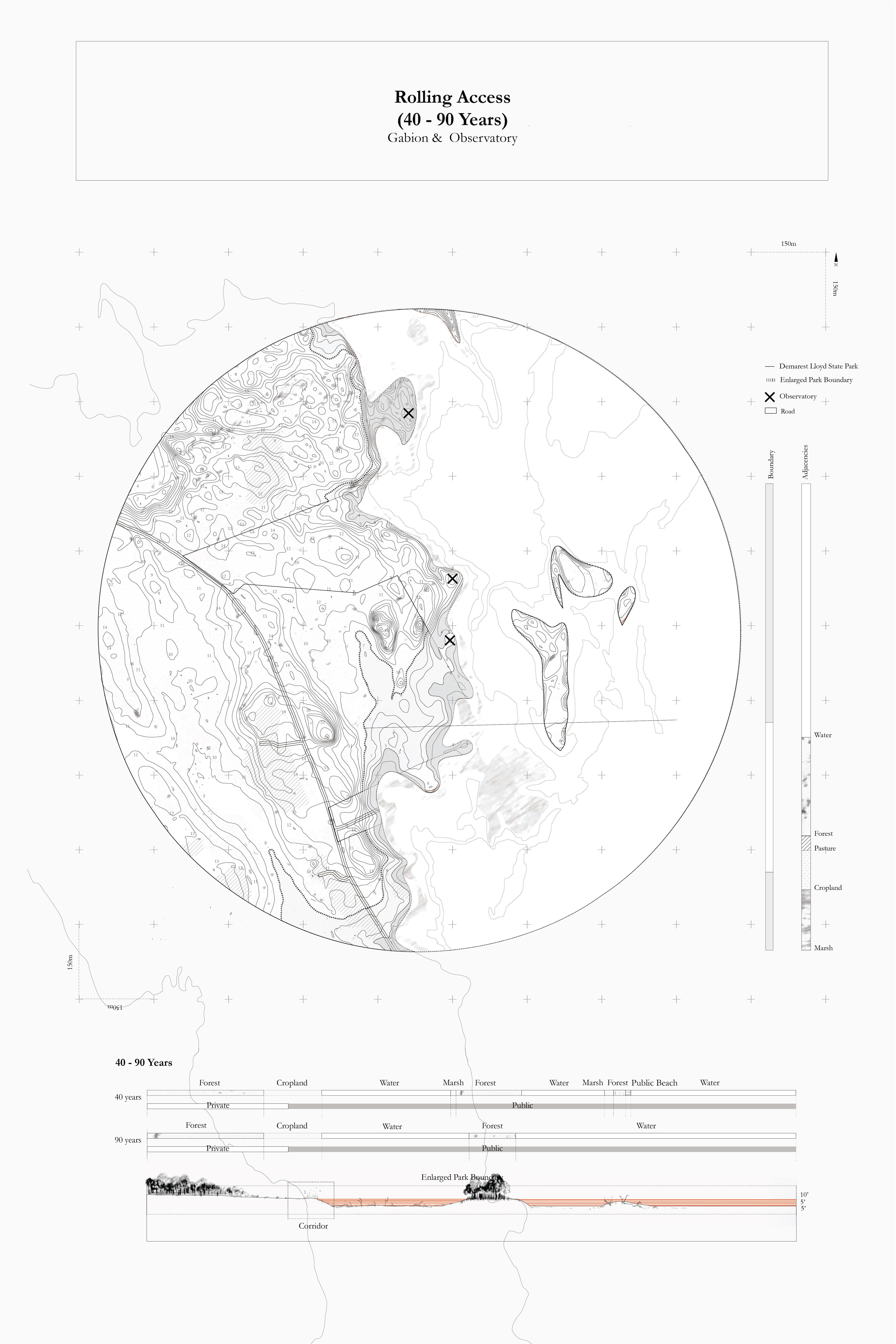
ROLLING ACCESS
Demarest Lloyd State Park currently offers a managed space for the community, as well as for those traveling down from the city of New Bedford. The park’s boundary is currently pinched between private land and the sea and as it rises, much of the park will transition to salt marsh, severely reducing the available public ‘land’.We propose the removal of a portion of this lot to be broken down, transported, and constructed into asphalt gabion seats that marks the edge of the future shoreline at high ground. These four observatories will offer views into the park, at land lost. This park can become a place where people can observe the past and present, of loss, risk, and retreat.
What is critical to understand about our project is how we have specifically chosen interventions that honor the use of the labor that they require. This process of asphalt deconstruction and reconfiguration, for example, can be conducted by 16 people with the use of only two hand carts.
CONSTRUCTION DOCUMENTS FOR A MANAGED RETREAT
Details outlining community managed strategies for retreat at each case study site.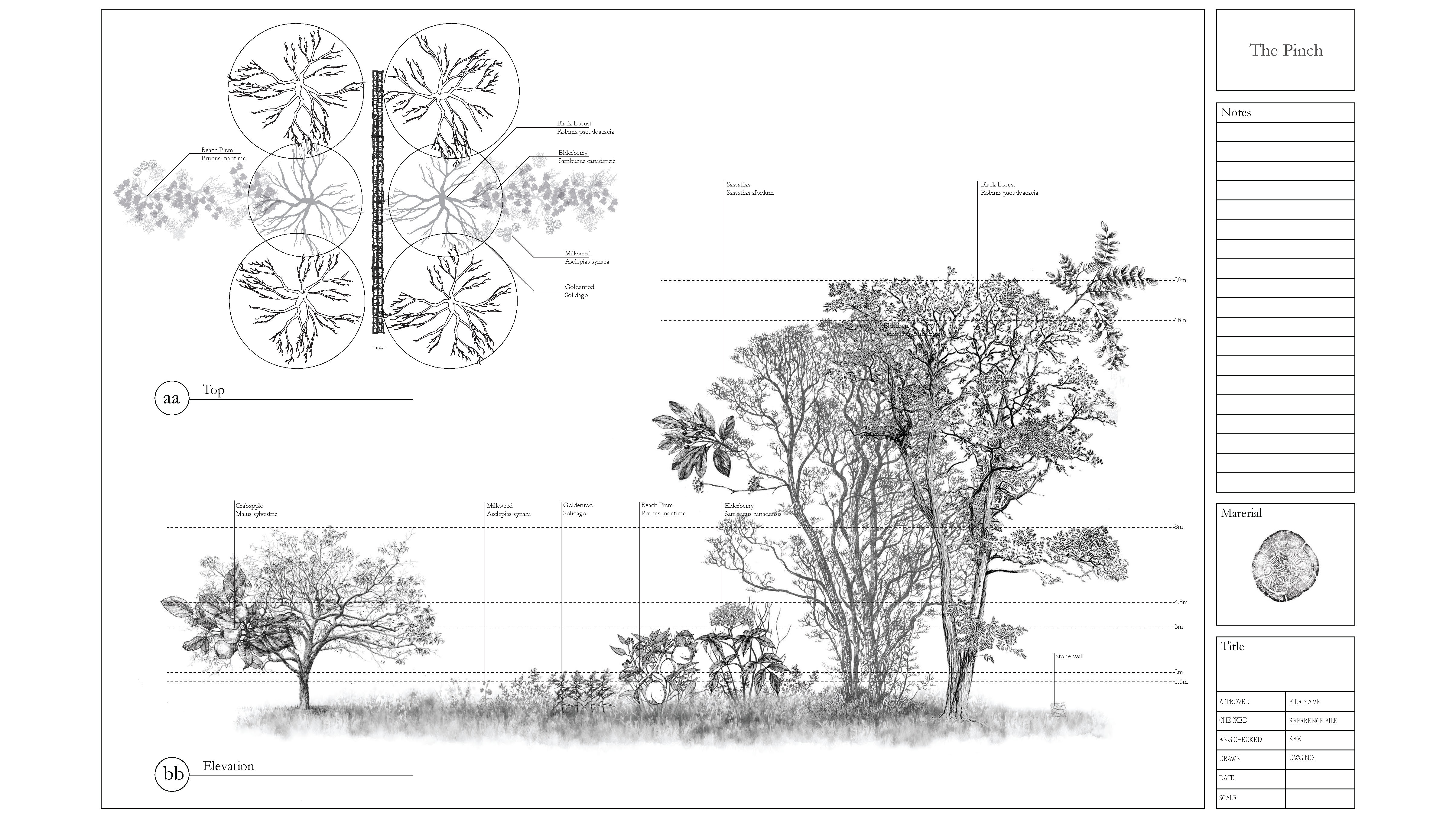


Change does not inherently translate to loss, it can encompass memory without nostalgia, address ownership through labor, and expand public access across formerly privatized shores. The pinch is an inherent gain that retools land-based practices and acknowledges risk for a community in retreat.
final presentation, harvard university graduate school of design, fall ‘19
︎︎︎